

Designing a commercial geothermal system that performs as intended requires direct measurement of the subsurface conditions at the specific site where that system will be built. At Darcy, the path from initial site interest to final system design runs through a structured investigation process.
The desktop study establishes what is likely underground, while on-site testing confirms it with physical data. Together, they give Darcy’s engineering team the information needed to specify a system with confidence rather than assumption, in addition to giving project owners a verified picture of their site’s geothermal potential before any major capital commitment is made.
In this piece, we’ll walk through the stages of that process, the testing methods used along the way, and what each one tells the design team and project owner.
Why Testing Comes Before Design, and Why It Varies by Site
Subsurface conditions are not uniform. Two sites in the same city, served by the same regional aquifer, can have meaningfully different groundwater depths, well yields, water temperatures, and water chemistry based on local geologic variation. Designing a geothermal system to regional averages and discovering those averages don’t apply to the specific site is an expensive problem to encounter during construction.
Testing exists to eliminate that risk, and no single method suits every site. The right program depends on the geology, the type of geothermal system under consideration, and how much reliable data already exists for the area. A site with extensive well records and a well-understood aquifer may need less field investigation than one with sparse data or complex geology. Each stage is designed to answer a specific set of questions about the site, with the results of each phase informing the scope of the next. At no stage does Darcy commit more resources, or ask a project owner to commit more resources, than the current level of site knowledge warrants.
Stage 1: The Desktop Geologic Evaluation
Darcy’s project process begins with a desktop geologic evaluation conducted by a Professional Geologist before any field work is planned or budgeted. The desktop study draws on published geologic maps, state geological survey well log databases, USGS groundwater data, aquifer characterization studies, and Darcy’s own internal database of project and assessment data accumulated across hundreds of site evaluations.
The objective at this stage is to build a preliminary subsurface model for the site, which includes:
- Identifying the most likely aquifer units present
- Estimating their depth, thickness, and expected yield range
- Reviewing water quality data from nearby wells
- Assessing whether the regulatory environment is likely to support the proposed system type
For groundwater-based systems, the desktop study also evaluates the likelihood that aquifer conditions will support the required system capacity.
The output is a written professional recommendation with an initial geological assessment of the site’s geothermal potential and a recommended path forward. This is Darcy’s free site assessment, and it is the starting point for every project engagement. Most desktop evaluations are completed within one to two weeks of receiving the site address.
From there, the desktop findings point to the right next step. Depending on the geology and the system type under consideration, that step may be surface geophysics, a design well program, or a test borehole for a closed-loop system, as outlined below.
Stage 2: Field Testing Methods Compared
Each testing method answers a different question about a site. The table below summarizes the methods most commonly used, what each does well, where each has limits, and what each contributes to the final design. Darcy’s team selects and sequences methods based on the geology, the system type being considered, and the data already available.
| Method | Strengths | Limitations | What it tells the design team |
| Desktop geologic evaluation Best suited for every site, as the first step. | Fast and low cost. Draws on existing maps, well records, and regional data. Screens out unsuitable sites before field work begins. | Depends on existing data, which can be sparse or dated near the site. Cannot confirm how an aquifer will perform at the specific location. | Likely aquifer units, depth and thickness, expected yield range, water quality trends, and the recommended next step. |
| Surface geophysics Best suited for sites with limited well data or variable geology. | Non-invasive and covers a broad area. Can help target where to drill. Costs less than drilling. | Provides indirect measurements that require interpretation. Cannot measure yield or water quality. Results can be affected by nearby infrastructure. | Variations in subsurface layering, likely depth to key units such as bedrock, and where to focus drilling. |
| Design well with pump test Best suited for groundwater-based systems, where aquifer productivity drives capacity. | Direct measurement of yield, aquifer properties, temperature, and water chemistry at the site. Produces data that supports final design and permitting. Can sometimes be converted into a production well. | Highest field cost and longest schedule of the methods listed. Requires drilling and permitting. Tests one location, so results are extended to other well locations through analysis. | Sustainable yield, aquifer hydraulic properties, groundwater temperature, water quality, and well construction details. |
| Slug test Best suited for a quick estimate of local aquifer properties, often early in a program. | Fast and low cost. Requires no large-volume pumping or water discharge. | Characterizes only the area near the well. Does not replicate the stress of long-term pumping. | Local hydraulic conductivity and inputs for designing a full pump test. |
| Closed-loop test borehole with thermal response test Best suited for sites without a productive aquifer or where groundwater-based systems are not a fit. | Measures the ground’s actual thermal properties at the site. Applicable in a wide range of geologies. Directly supports borehole field sizing. | Test runs for multiple days. Reflects a single borehole, so results are applied across a larger field. Provides no information about groundwater resources. | Ground thermal conductivity and undisturbed ground temperature, used to size a borehole field. |
In practice, the methods work together. Surface geophysics can narrow where a design well is drilled, a slug test can shape the design of a pump test, and the desktop evaluation can point toward a closed-loop test borehole from the start.
A Closer Look at the Design Well Program
The design well program is where desktop data meets physical reality for groundwater-based systems. A design well (sometimes called a pilot well or test well in other geothermal contexts) is a borehole drilled to the target aquifer horizon, instrumented and tested in the field, and used to characterize the subsurface conditions that will govern the final system design.
Well Drilling and Construction
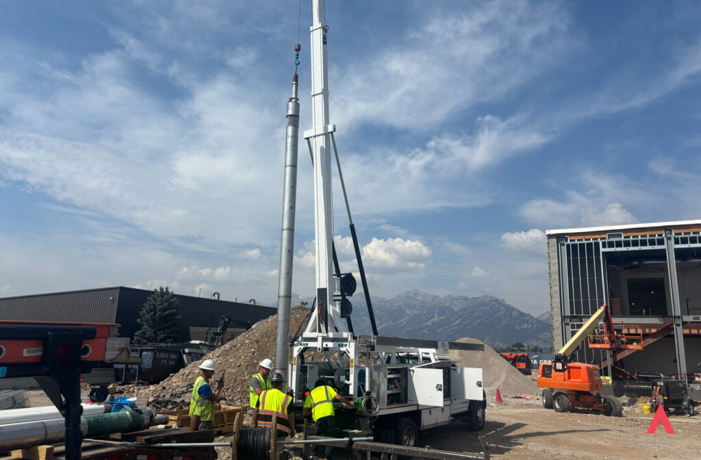
The design well is drilled to the target depth determined by the desktop evaluation, and the drilling method is selected based on the expected geology. Air rotary and down-the-hole (DTH) hammer methods are commonly used in harder consolidated formations, while mud rotary is commonly used in unconsolidated sediments such as sand and gravel. Each approach carries tradeoffs in speed, cost, and how cleanly the formation can be sampled, and other methods may suit specific site conditions.
As drilling advances, the borehole is continuously logged. Drill cuttings are collected at regular depth intervals, described and archived by Darcy’s geology team, and used to update the subsurface model in real time. Any deviation from the geology predicted in the desktop evaluation is documented and evaluated as it is encountered. The live feedback between drilling and geology is one of the reasons Darcy’s design well programs are conducted with dedicated on-site geological oversight rather than left entirely to the drilling contractor.
Geophysical Borehole Logging
After the borehole reaches target depth, a suite of geophysical logging tools can be used to collect continuous measurements of the formation’s physical properties. Depending on site conditions and system type, this may include:
- Natural gamma ray logging: Used to differentiate fine-grained low-permeability units from coarser, more permeable zones
- Fluid conductivity and temperature logging: Characterizes the groundwater column and identifies zones of active groundwater inflow
- Caliper logging: Measures borehole diameter and identifies washouts or tight zones
- Flowmeter logging under pumping conditions: Identifies the specific depth intervals contributing groundwater to the well
The geophysical log suite gives Darcy’s geology team a precise picture of where in the borehole productive aquifer zones exist, how they are distributed with depth, and how the formation properties compare to the desktop predictions. This is the data that drives well screen placement, pump setting depth, and, for Dipole configurations, the engineering of the subsurface flow field.
Aquifer Pump Testing
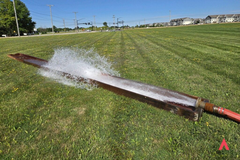
The aquifer pump test is the core productivity measurement of the design well program. A pump is set in the well and run at a controlled rate for a sustained period, typically several hours to several days depending on the site and the information needed. Water levels are measured in the pumped well and, where available, in nearby monitoring wells or existing water supply wells.
Analysis of the test data produces the aquifer’s transmissivity, hydraulic conductivity, and storativity, along with the sustainable well yield at design pumping rates. In practical terms, these results describe how readily the aquifer transmits water, how much water it releases from storage, and how it responds to sustained pumping. They directly inform system sizing, well count, and the spacing between production and injection wells.
After the pump is shut off, water levels in the well recover toward their pre-test static level. This recovery period is measured and analyzed separately, providing an independent estimate of aquifer transmissivity that validates the pump-on analysis. The combination of drawdown and recovery data gives Darcy’s hydrogeologists a robust and defensible characterization of the aquifer’s behavior under the stress of geothermal production.
Slug Testing
In addition to or in place of a full pump test at some design well locations, Darcy’s team may conduct slug tests, which are rapid measurements of aquifer hydraulic response made by suddenly introducing or removing a known volume of water (or a solid slug) from the well and measuring the rate at which the water level returns to static. Slug tests are faster and less resource-intensive than pump tests and are particularly useful for characterizing hydraulic conductivity at the immediate well scale. They are often used during the early phase of a design well program to inform pump selection and pump test design before the full multi-hour test is initiated. Because they measure only the area close to the well, slug tests complement a full pump test in programs where long-term yield must be confirmed.
Groundwater Temperature Profiling
Groundwater temperature is logged at multiple stages of the design well program, both under static conditions and under pumping. Static temperature profiles reveal natural thermal gradients in the groundwater column and identify inflow zones with distinct temperatures. Pumping temperature measurements characterize the temperature of the produced water at design flow rates and across the anticipated range of seasonal operating conditions. These measurements are the thermal design inputs that Darcy’s engineering team uses to model heat exchanger performance, system capacity, and seasonal coefficient of performance (COP) for the proposed system.
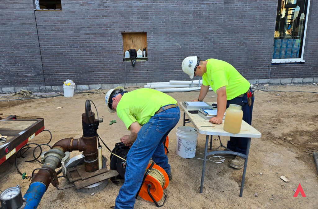
Water Quality Sampling
Representative water quality samples are collected during pumping at specified flow rates and analyzed for the parameters most relevant to geothermal system design:
- Dissolved iron and manganese (which can cause scaling or biofouling in heat exchangers)
- Total hardness (which affects carbonate scaling potential)
- pH and alkalinity
- Total dissolved solids
- Silica
- Any site-specific constituents identified as potentially relevant during the desktop review
Corrosion and scaling indices are calculated from the laboratory results.
Water quality is a primary consideration in design well programs, as the chemistry of the produced water directly determines heat exchanger material selection, treatment system requirements, and the long-term maintenance expectations for the installed system. A site with high iron or calcium hardness requires design accommodations that a low-TDS site does not, and addressing chemistry at the design stage costs a fraction of what it costs to retrofit a system that was not specified appropriately.
How Darcy Manages the Program
Darcy manages the design well program from start to finish, including permitting, contractor procurement, field oversight, data collection, quality assurance, and results reporting. Well construction permits and groundwater appropriation or testing permits (when required) are handled as part of the program. Programs typically run 2–6 weeks from mobilization to delivery of the final results report, depending on testing scope, site access, drilling schedule, and laboratory turnaround times.
Testing is performed at cost with no markup, consistent with Darcy’s commitment to making the path to a confirmed geothermal project as accessible as possible. For projects where Darcy’s Dipole Well technology is the proposed approach, the design well may also be converted into a production well instead of being decommissioned after testing, depending on the test results and the final system layout.
Stage 3: Results, Reporting, and System Design
After field work is complete and laboratory results are received, Darcy’s geology and engineering teams compile the findings into a comprehensive results report delivered to the project owner and design team. The report documents the complete subsurface dataset from the methods used on the site, which may include the geological log, geophysical log suite, pump test analysis, temperature profiles, and water quality results, along with Darcy’s interpretation of what each dataset means for system design.
The report includes a final recommendation for system configuration, well count and spacing, pump specifications, heat exchanger type and material selection, and any treatment or operational requirements indicated by site conditions. For projects where the design well will be converted into a production well, the report also specifies the permanent well completion design, including screen intervals, casing specifications, and grouting requirements.
This report is the foundation for Darcy’s formal project proposal. It replaces assumption with measurement, and it allows the project owner to make the decision to proceed with full system construction based on a thoroughly characterized understanding of what their site can deliver.
For the engineering team, the report provides the measured site parameters needed to design a system that will perform as specified over its full operating life. For the project owner, it provides independent, documented evidence of the site’s geothermal potential that can support financing decisions, board presentations, regulatory applications, and incentive program documentation.
If testing returns results that differ from desktop predictions, such as lower-than-anticipated well yield or unexpected water chemistry, Darcy presents options to the project team. These may include adjusting the system design to match confirmed site conditions, expanding the testing program to investigate other aquifer zones, or recommending a closed-loop approach where groundwater-based configurations are not supported. Identifying these conditions early keeps the cost of adjusting course low.
Geothermal systems are long-lived infrastructure assets, with the underground wellfield serving the building for 50 years or more. Getting the design right requires knowing exactly what the subsurface looks like at that specific location, and the testing program at Darcy is how we make sure of that.
The Testing Program Starts with the Desktop Study
Field testing is the most technically intensive phase of a geothermal project before construction begins, and it produces the most consequential data in the project workflow. It begins only after the desktop geologic evaluation establishes that the site warrants it, and that same evaluation determines which testing methods fit the site.
Darcy’s site assessment is free, is conducted by a licensed Professional Geologist, and delivers an initial site recommendation within one to two weeks of receiving the site address. For projects that advance, the desktop assessment becomes the geological foundation for everything that follows.